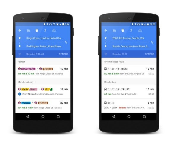
Maps may soon be your best friend when it comes to catching the train.
The app now shows real-time transit updates in San Francisco, Chicago, Seattle, with a promise of more cities to come. The new feature is also live across the pond, debuting in the UK, Netherls, Budapest.
says that Maps uses over 100 different transportation partners for collecting the data, so you’ll have the very latest arrivals departures for systems like BART or ndon’s Underground.
 t ng Blog
 Maps offers up suggested routes for various forms of public transit.
The route arrangement has also been rearranged to provide different options. en you select one, Maps will also ping you for late arrivals so you can stop your sprint if you think you’re late for the train, but it’s running behind.
The new features are already live in the Maps Android app the iOS app, too. You may not see the change right away; it’s live on some of our test phones, but not on others.
y this matters: Maps is the current leader in mapping thanks to the massive amount of data the company has. But it can’t rest, especially with Apple planning to roll out transit data to its own maps application for iOS. There’s also competition on Android, with some good alternatives like Transit Moovit.


